


- x
- Powder River Basin (Geological)
- Madison Formation
- Wallula Basalt Pilot
- Cropland (Terrestrial)
- Forestry (Terrestrial)
- Rangeland (Terrestrial)
Carbon Storage Atlas
Lat/Long
The forestry study was centered in the Palouse Range (~20,000 hectares [ha]; Latitude 46° 48′ N, Longitude 116° 52′ W), located in northern Idaho, USA (Figure 2).
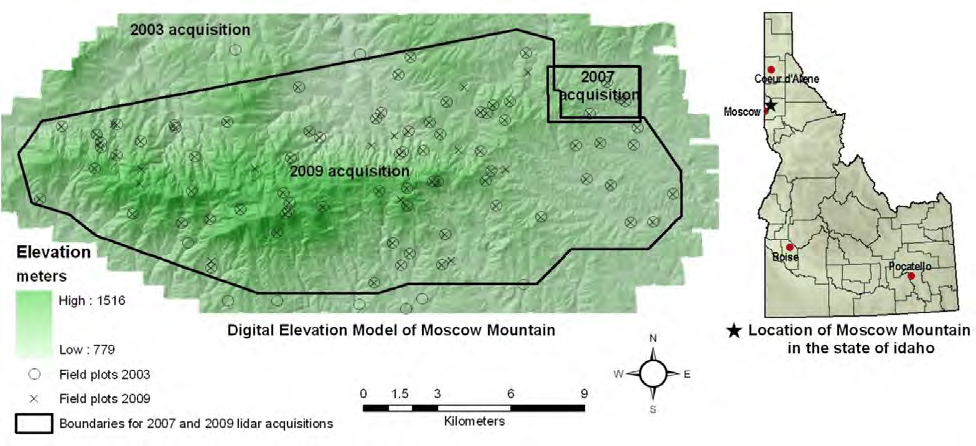
Location of the Moscow Mountain study area in north central Idaho. The extent of the digital elevation model (DEM) reflects the boundary of the 2003 light detection and ranging (LiDAR) survey.
Why this Location
The forest chosen for study is representative of many forests around the globe in that it is managed by multiple user groups, including industrial forestry companies, private owners, and public land managers. This has resulted in a forest that is diverse in species composition, stand age, and structure, representing a variety of biophysical settings and forest successional stages. Major disturbances occurring during the time period 2003 to 2009 include forest management such as harvest, thinning, and prescription fire. This collection of conditions made it an attractive study site to monitor broad-scale changes in aboveground forest biomass across large tracts of land.
Main Research Q&As Discovered
Sound policy recommendations relating to the role of forest management in mitigating carbon dioxide (CO2) depend upon establishing accurate methodologies for quantifying forest carbon pools for large tracts of land that can be dynamically updated over time. Light detection and ranging (LiDAR) remote sensing is a promising technology for achieving accurate estimates of aboveground biomass and thereby carbon pools; however, not much is known about the accuracy of estimating biomass change and carbon flux from repeat LiDAR acquisitions containing different data sampling characteristics. In this study, estimates of biomass as a function of management practices and successional forest stages were made, and spatiotemporal patterns of aboveground biomass accumulation in a heavily managed conifer forest were quantified. Overall, multi-temporal discrete return airborne LiDAR data coupled with field reference data and statistical modeling techniques offer a powerful method for calculating pools and changes in aboveground carbon in forested systems. The results of the study suggest that multitemporal LiDAR-based approaches are likely to be useful for high-quality estimates of aboveground carbon change in conifer forest systems.
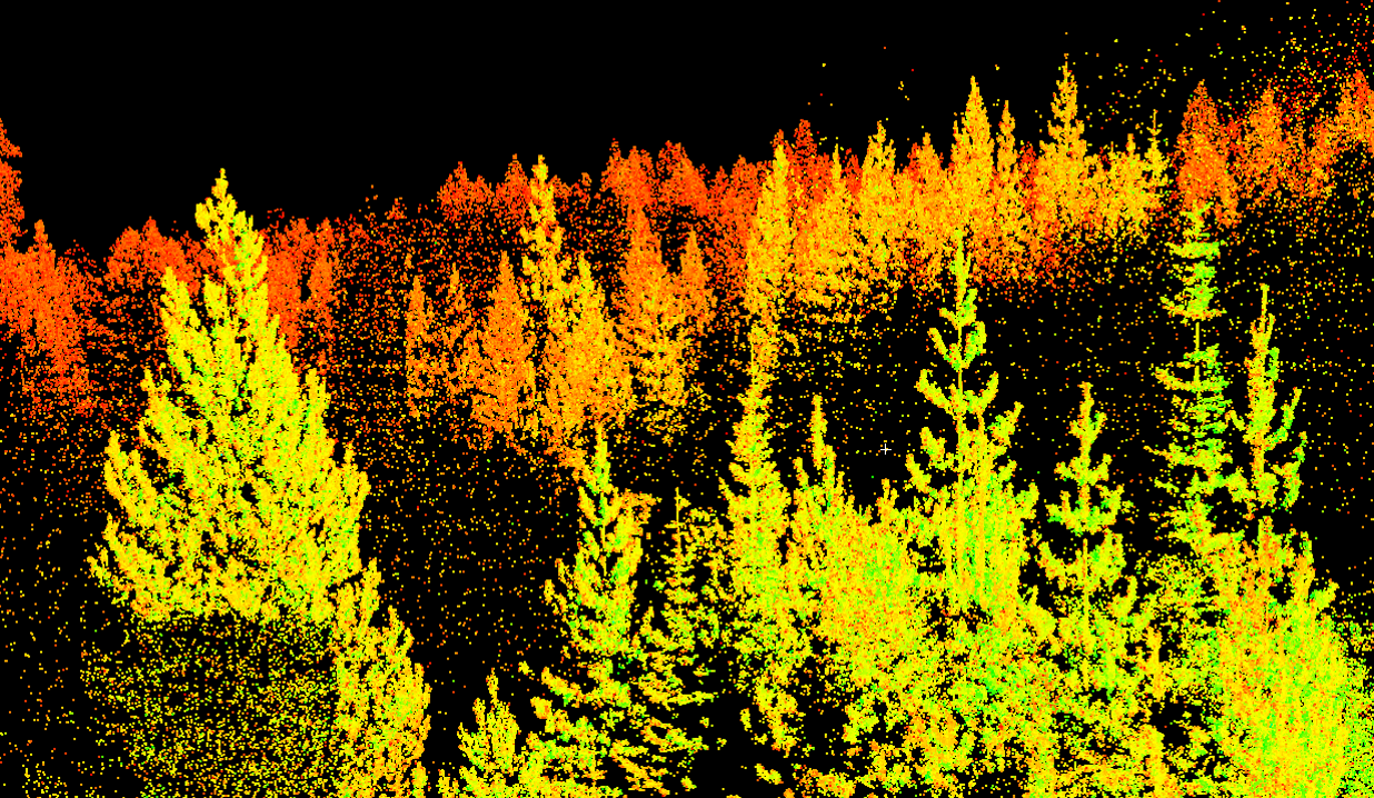
Light detection and ranging (LiDAR) image taken at forestry study site.
Lessons Learned
Sound policy recommendations relating to the role of forest management in mitigating atmospheric carbon dioxide (CO2) depend upon monitoring broad-scale changes in aboveground forest biomass across large tracts of land. Although information from traditional passive satellite remote sensing has contributed to regional estimates of Gross Primary Production (GPP) and Net Primary Production (NPP), challenges remain in optimizing the spatial resolution of remotely sensed data for specific applications and differentiating the relative influences of vegetation structure and chemical variables. In this study, the utility of using multi-temporal discrete return airborne Light Detection and Ranging (LiDAR) surveys in concert with field sampling and statistical modeling techniques to quantify spatiotemporal patterns of aboveground biomass accumulation in a heavily managed conifer forest was demonstrated.
Links to EDX
Quantifying Forest Aboveground Carbon Pools and Fluxes Using Multi-temporal LIDAR
Sound policy recommendations relating to the role of forest management in mitigating atmospheric carbon dioxide (CO2) depend upon establishing accurate methodologies for quantifying forest carbon pools for large tracts of land that can be dynamically updated over time. Light Detection and Ranging (LiDAR) remote sensing is a promising technology for achieving accurate estimates of aboveground biomass and thereby carbon pools; however, not much is known about the accuracy of estimating biomass change and carbon flux from repeat LiDAR acquisitions containing different data sampling characteristics. In this study, discrete return airborne LiDAR data were collected in 2003 and 2009 across ~20,000 hectares (ha) of an actively managed, mixed conifer forest landscape in northern Idaho, USA. Forest inventory plots, established via a random stratified sampling design, were established and sampled in 2003 and 2009. The Random Forest machine learning algorithm was used to establish statistical relationships between inventory data and forest structural metrics derived from the LiDAR acquisitions. Aboveground biomass maps were created for the study area based on statistical relationships developed at the plot level.