


- x
- Powder River Basin (Geological)
- Madison Formation
- Wallula Basalt Pilot
- Cropland (Terrestrial)
- Forestry (Terrestrial)
- Rangeland (Terrestrial)
Carbon Storage Atlas
Lat/Long
Field studies were conducted at six farmer-managed sites (~32 ha) within Montana’s Golden Triangle (Figure 1).
|
Location |
Latitude |
Longitude |
|
Dutton, MT |
47°58'37.08"N |
111°44'42.87"W |
|
Power, MT |
47°40'50.46"N |
111°34'38.47"W |
|
Chester, MT |
48°43'07.20"N |
110°51'45.95"W |
|
Conrad, MT |
48°18'44.37"N |
111°55'50.20"W |
|
Fife, MT |
47°29'13.59"N |
111°00'17.92"W |
|
Kremlin, MT |
48°31'41.36"N |
110°01'56.91"W |
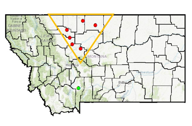
Location of six farm-managed field sites (red dots) and complementary field experiment conducted at the Montana State University (MSU)-Post farm (green dot). Approximate boundary of the Golden Triangle indicated in orange.
Why this Location
Terrestrial carbon storage research in the Great Plains has focused on the available nitrogen (N) and carbon storage relationships and how best management practices (BMPs), such as annual cropping and no-till (NT), can be adopted to enhance carbon. Although BMPs to store carbon in agricultural soils have been identified, the storage rates remain unknown for some regions of the northern Great Plains due to the absence of long-term cropping system studies. Montana’s Golden Triangle represents one such region. This region is defined on the north by the border with Canada, on the west by the eastern front of the Rocky Mountains, and on the east by a line-transect between Great Falls and Havre. This is Montana’s largest grain growing region with more than 2 million hectares of land annually in wheat production. Largely managed under alternate year cropping rotations with varying levels of tillage intensity, the soils of this region have the potential to act as a carbon sink. The purpose of this research was to quantify soil carbon storage rates in response to agricultural BMPs, including NT and annual cropping, on six representative well-managed farms in Montana’s Golden Triangle.
Main Research Q&As Discovered
The goals of the Big Sky Carbon Sequestration Partnership (BSCSP) cropland studies were to: (1) quantify and determine cropland management practices that optimize carbon storage, and (2) develop monitoring, verification, and accounting (MVA) protocols to evaluate carbon storage for enrolled farms. To determine the rates of terrestrial carbon storage resulting from both increased cropping frequencies and decreased tillage in north central Montana’s dryland wheat production, soil samples were collected bi-annually with yields and management monitored annually over the course of six years. It was hoped that six years of consecutive management would result in cumulative changes in soil organic carbon (SOC), which could be detected and used to determine annual rates of terrestrial carbon storage resulting from the two treatment factors. Differences between baseline SOC data and SOC data from the sixth year of the story unfortunately were not consistent with well-established carbon storage trends for either of the treatment factors being studied.
Results from this study, conducted at controlled farm-managed sites in northern Montana, as well as a companion study near Bozeman, revealed that adoption of annual cropping practices to replace fallow-wheat will lead to greater SOC storage in Montana. The impact of no-till (NT) on soil carbon storage was less clear in this study. In part, this was due to the fact that tilled systems applied at the farm-managed sites were not very intensive, and so the difference in level of disturbance between till and NT systems was not great. Although, the direct impact of NT on SOC will likely be less than annual cropping, the importance of NT should not be understated. NT management conserves water; therefore, its adoption can be critical to the success of more intensive annual cropping systems in semiarid climates, such as Montana.
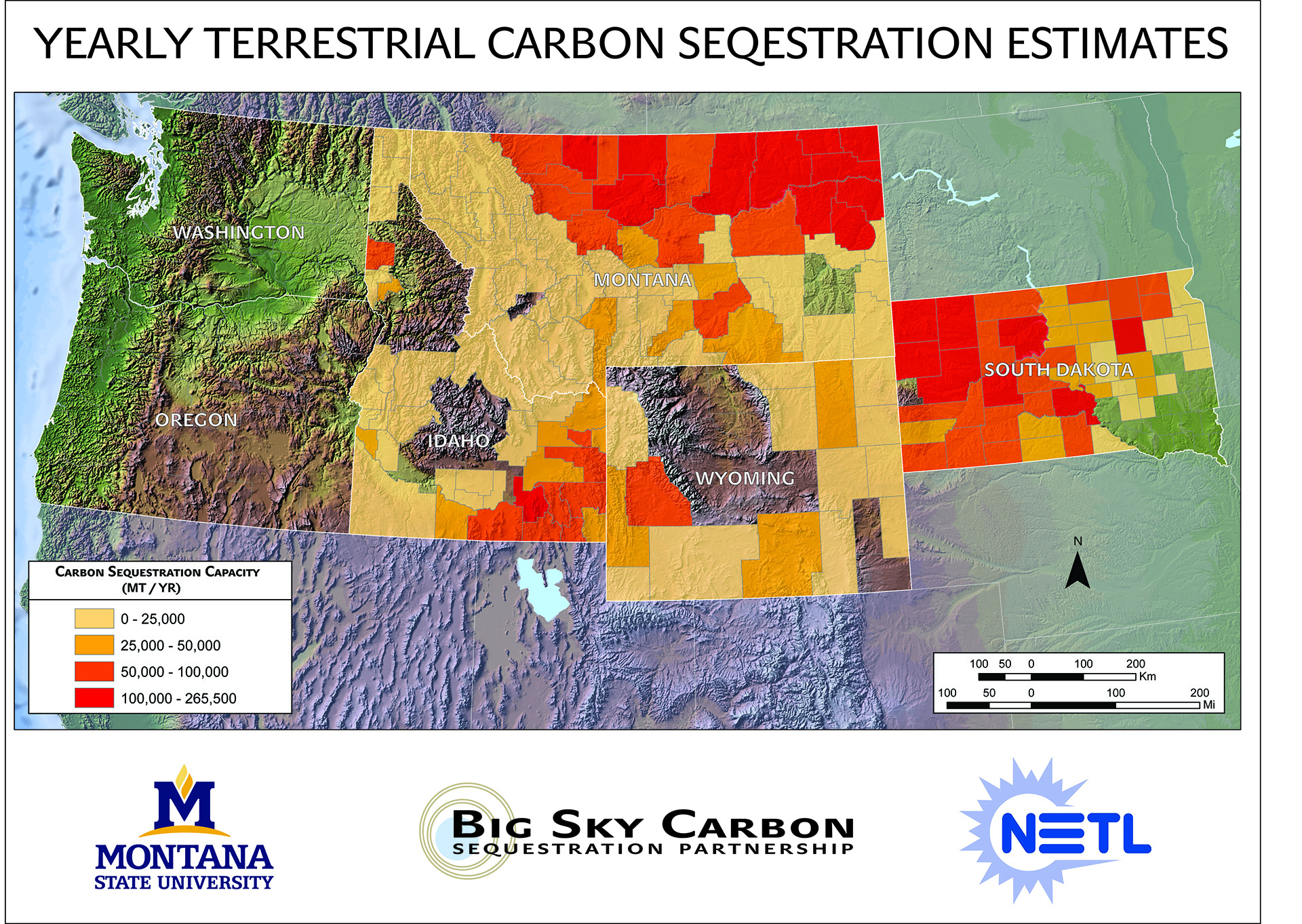
Yearly terrestrial carbon storage estimates for Montana, Idaho, Wyoming, and South Dakota.

Tractor plowing at terrestrial pilot site.
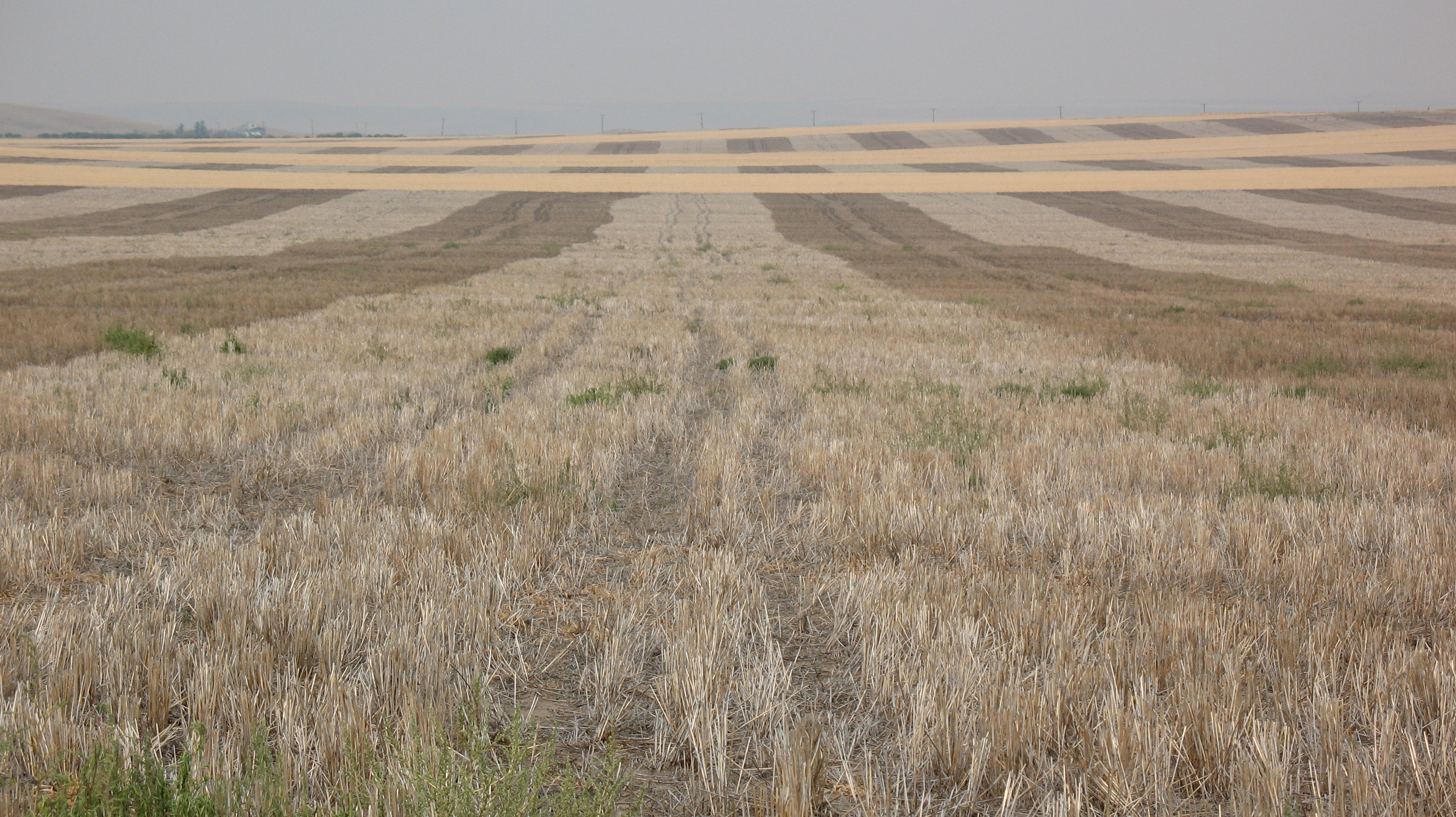
Terrestrial pilot cropland.

Measuring CO2 at pilot site.
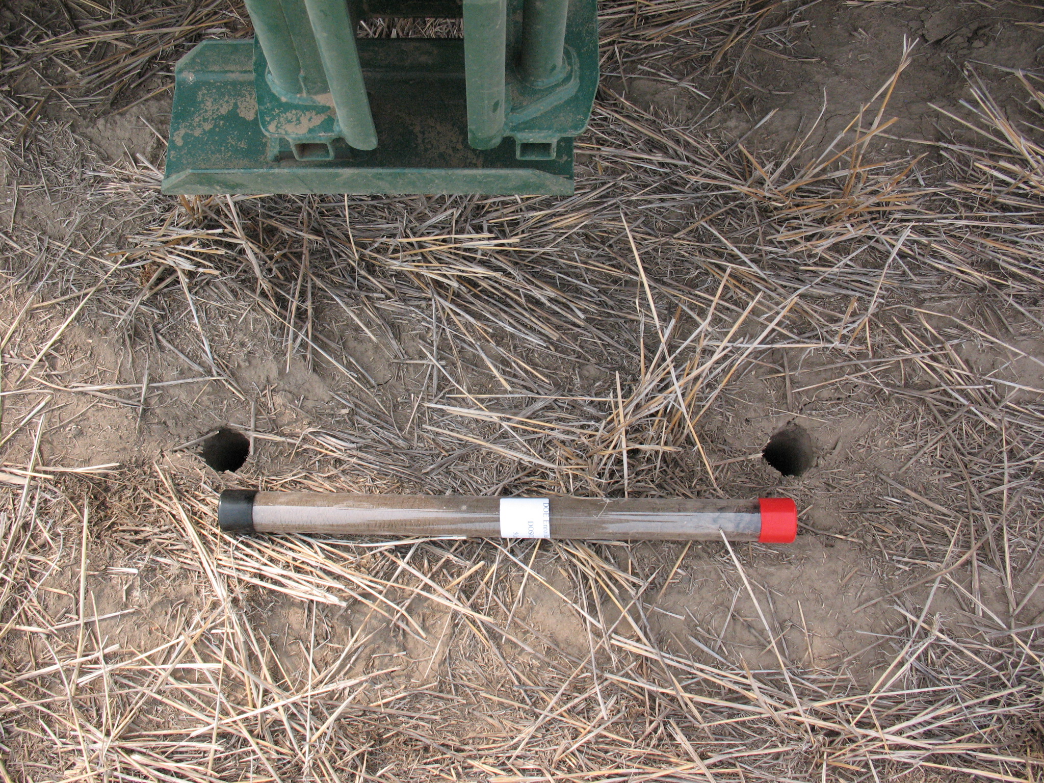
Intact soil core collected at participating farm.

Visible (Vis) near-infrared (NIR) Instrument.
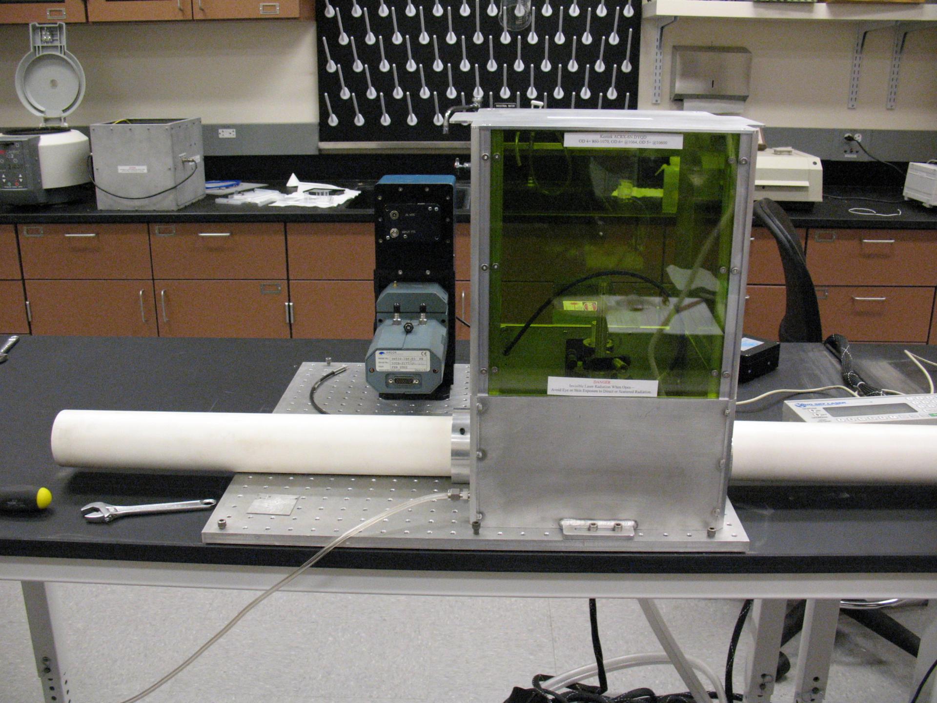
Laser-induced breakdown spectroscopy (LIBS) Instrument.
Lessons Learned
Unmineable coalbeds are potentially large storage reservoirs for the storage of anthropogenic carbon dioxide (CO2) and offer the benefit of enhanced methane production, which can offset some of the costs associated with CO2 storage. An economic feasibility study in the Powder River Basin of Wyoming was conducted and economic analyses of CO2 injection options were compared. The cost to separate CO2 from flue gas was identified as the major cost driver associated with CO2 storage in unmineable coal seams in the Powder River Basin. In order to achieve economic viability, some form of government incentive would need to be imposed to drive the cost to separate CO2 from flue gas to less than zero. Technological breakthroughs could aid the economics, but would not be expected to accomplish all that is necessary.
Links to EDX
Montana Cropland Enrolled Farm Fields Carbon Sequestration Measurement Monitoring and Verification
There is growing need for rapid, accurate, and inexpensive methods to measure, and verify soil organic carbon (SOC) change for national greenhouse gas (GHG) accounting and the development of a soil carbon trading market. Laboratory-based soil characterization typically requires significant soil processing, which is time- and resource-intensive. This severely limits application for large-region soil characterization. Thus, development of rapid and accurate methods for characterizing soils are needed to map soil properties for precision agriculture applications, improve regional and global soil carbon (C) stock and flux estimates and efficiently map sub-surface metal contamination, among others. The greatest gains for efficient soil characterization will come from collecting soil data in situ, thus minimizing soil sample transportation, processing, and lab-based measurement costs. Visible and near-infrared diffuse reflectance spectroscopy (VisNIR) and laser-induced breakdown spectroscopy (LIBS) are two complementary, yet fundamentally different spectroscopic techniques that have the potential to meet this need. These sensors have the potential to be mounted on a soil penetrometer and deployed for rapid soil profile characterization at field and landscape scales. Details of sensor interaction, efficient data management, and appropriate statistical analysis techniques for model calibrations are first needed.
Cropland Controlled Site Experiments Final Report
The Big Sky Carbon Sequestration Partnership (BSCSP) project sponsored terrestrial carbon storage field studies at “farm-managed sites” in northern Montana near Fife, Chester, Power, Dutton, and Conrad during Phase III. The overall objective of these studies was to determine whether adoption of tillage reduction (i.e., no-till) and annual cropping practices would result in soil carbon storage; and if so, at what rate. A 10-year study (2002 to 2012) was conducted at 5 farm-managed sites in northern Montana and on the property of the Montana State University (MSU)-Post Farm near Bozeman. The MSU-Post Farm trial was conducted with funds from the Montana Agricultural Experiment Station. Soil cores were collected in 2012, processed, and then analyzed for organic carbon. Estimates of soil organic carbon (SOC) mass for different profile depths were calculated for the farm-managed sites (i.e., 0 to 20 centimeters and 0 to 50 centimeters) and MSU-Post Farm (0 to 30 centimeters). Estimates of SOC mass were contrasted with baseline numbers in 2002 (or 2004), where comparison could be reliably made. This study found that terrestrial carbon storage was possible in Montana’s dryland cropland soils by replacing fallow-wheat with more intensive cropping practices, such as annual, pulse-wheat rotations. The impact of a reduction in tillage on carbon storage was somewhat unclear, but it appeared to be considerably less important than cropping intensity. Estimated SOC storage response averaged 0.32 metric tons of carbon per hectare per year, or 1.17 MT CO2 equivalent per hectare per year over five sites where responses to increasing cropping intensity were observed. As anticipated, there was considerable variance (0.18 to 0.60 metric tons of carbon per hectare per year) in soil carbon storage rates among the responsive sites. The largest carbon storage in response to cropping intensity was observed at Fife, which was characterized by high soil clay content (60%). Currently, Montana ag-statistics indicate that approximately 1.29 million hectares of farm land (3.19 million acres) are in fallow on an annual basis. Approximately 72% of the fallow-wheat acreage (or 925,000 hectares) is found in Montana’s Golden Triangle, plus three other neighboring counties. If we apply our mean soil carbon storage rate to this acreage, then the potential of terrestrial carbon storage in Montana following conversion of fallow-wheat to annual cropping equates to approximately 1.0 million MT of CO2 per year.
Cropland Controlled Test Field Validation Final Report
To determine the rates of terrestrial carbon storage resulting from both increased cropping frequencies and decreased tillage in north central Montana’s dryland wheat production, soil samples were collected bi-annually with yields and management monitored annually over the course of six years. It was hoped that six years of consecutive management would result in cumulative changes in soil organic carbon (SOC), which could be detected and used to determine annual rates of terrestrial carbon storage resulting from the two treatment factors.
Differences between baseline SOC data and SOC data from the sixth year of the story unfortunately were not consistent with well-established carbon storage trends for either of the treatment factors being studied. In fact, these comparisons resulted in suggested changes in SOC that were identified as highly improbable. Substantial variation in baseline SOC data was identified as the most likely culprit for the questionable storage rates.
Because of the concerns with the baseline data, comparisons among treatments at each of the six field sites were made assuming a common unknown baseline. The comparisons resulted in differences (P < 0.05) that were consistent with the established carbon storage trends being detected in the 0 to 10 centimeters soil profile for two of the six sites tested.
An additional test, the active microbial biomass carbon (AMBC) test, was employed as a means of detecting differences in AMBC pool as a means of indicating changes that are occurring in the total SOC pool. The results of the AMBC test showed no statistical difference between the treatments for the two sites tested, but the signal may have been diminished due to a one-year storage time of the soil samples prior to testing.
Attempts to characterize the response of the AMBC test to sterilized soil produced unexpected results, which need to be further investigated so modifications to the AMBC test using sterile soil as a means of standardization across time cannot be recommended at this time.
Cropland Remote Sensing Models Final Report
A Big Sky Carbon Sequestration Partnership (BSCSP) research team examined the utility and developed methods for monitoring cropping practices in north-central Montana that are currently subject to potential carbon credit trading. The advantage of developing remote sensing methods for this purpose is to provide monitoring and validation over large areas to support carbon trading markets.
The research team used an object-oriented approach in conjunction with the Random Forest algorithm to classify agricultural practices, including tillage (till or no-till [NT]), crop intensity, and grassland-based conservation reserve (CR). This study hypothesized that the inclusion of high temporal data into the classification process would increase conservation tillage accuracy due to the added likelihood of capturing spectral changes in Montana fields following a tillage disturbance. Classification accuracies were evaluated for Random Forest models based on 250-m and 500-m MODIS, 30-m Landsat, and 30-m synthetic reflectance values.
These remote sensing methods enabled the team to establish regional percentage estimates of cropland under NT as influenced by prior tillage management, various degrees of crop intensity, and CR within north-central Montana. Literature-based carbon storage estimates were used to generate carbon gain data associated with the conversion to NT and to CR. These estimates were then applied to the area-based cropland statistics to estimate potential regional carbon storage associated with these management changes.
Results for this study indicated that an estimated 26% of the evaluated research region was under a grassland-based CR management in 2007, yet only 2% of this area was documented as being under current CRP contract. For cropland management, findings estimated that 56% of the region used NT in 2007, while 44% remained under a tillage-based management. Correspondingly, potential regional storage estimates for north-central Montana were calculated at 18,855 t C per year (69,198 t CO2 per year). For tillage and minimal-tillage (MT) lands, estimates showed that 46,555 to 60,522 t C per year (170,857 to 222,116 t CO2 per year) might be stored within the 0 to 20 centimeters soil depth. The predicted regional SOC storage was found to be more moderate for the MT-to-NT assumptions (37,244 t C per year), and was expectedly higher under an intensive tillage-to-NT adjustment (55,866–81,472 t C per year). Values for storage potential are additionally influenced by specific environmental inputs, such as vegetation type, soil nitrogen levels, crop type, livestock management, and other variables that should be considered in potential storage analyses.