


Carbon Storage Atlas
Tech Transfer
Big Sky Carbon Sequestration Partnership (BSCSP) data and site access has contributed to development of tools and models that can be more broadly applied to carbon storage and subsurface operations. In the area of seismic processing, BSCSP and partners have developed methods for joint inversion of P-waves, multiple S-waves, and converted waves that result in better contrast for multi-component 3D data. Additionally, full wave inversion techniques have also been advanced. New testing capabilities were developed to measure seismic response in fractured materials and imbibition and draining in dual permeability (fracture/matrix) samples. Two different fracture/matrix dual permeability simulation models have been developed or tested using BSCSP data and are being made publicly available for use on fractured reservoirs. BSCSP provided site access to GroundMetrics and TechnoImaging to test borehole-to-surface electromagnetic imaging (BSEM) feasibility with forward modeling indicating that an injected plume could be imaged with good contrast. An unsupervised classification system was developed to improve processing and interpretation of hyperspectral imaging data for near-surface anomaly detection. Contribution to improved processing techniques and simulator development is expected to continue beyond the life of the project as a result of naturally fractured carbonate reservoir core samples, tight carbonate and anhydrite caprock core samples, log data, and unique seismic data from the project being made publicly available.
Story of Interest
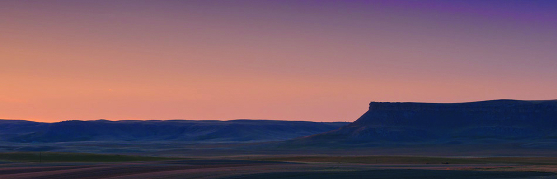
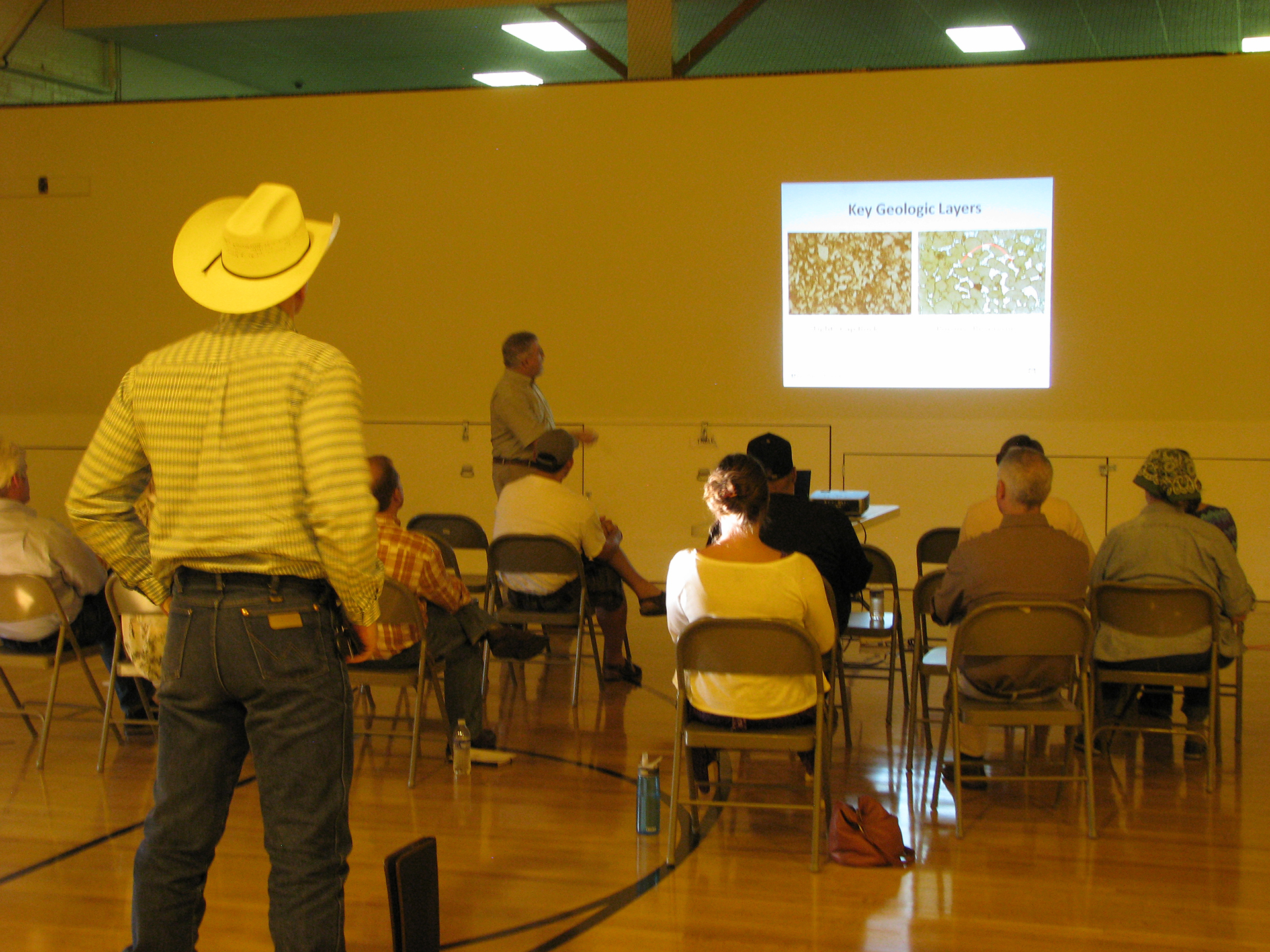
One challenge when communicating carbon capture and storage (CCS) activities with the general public is conveying information about the subsurface, including differences in rock properties and scale. Being careful to represent scale properly on graphics and diagrams helps, but doesn’t completely solve the problem. Also, comparing depths to surface distances doesn’t clearly convey scale because people seem to process horizontal and vertical distances differently. A prominent natural feature in the Kevin Dome region is the Kevin Rims, a butte that stands at approximately 137 meters (450 feet) from base to top. This provided the Big Sky Carbon Sequestration Partnership (BSCSP) with a convenient comparison for two reasons: (1) the Kevin Rims have approximately the same thickness as the primary and secondary caprocks (primary – Upper Duperow; secondary – Nisku and Potlach anhydrite), and (2) all stakeholders and community members are very familiar with them. In meetings and outreach activities in the region, BSCSP would include a scaled photograph of the Kevin Rims beside the caprock layers in diagrams showing site stratigraphy to indicate the thickness of the sealing layers. BSCSP would also discuss how the primary seal has held carbon dioxide (CO2) in place for 50 million years, how anhydrites are the “gold standard” for caprocks, and that much thinner anhydrite layers provide effective seals in many locations. This communication strategy was very effective in generating confidence from individuals who initially expressed concerns. Comparison to the Kevin Rims made the geologic depth scale tangible to the general public.
Regional Accomplishments
The Big Sky Carbon Sequestration Partnership (BSCSP) developed two web-based tools that are publicly accessible. The first is an interactive map that combines data layers from several sources to provide extensive, publicly available custom mapping functionality. In a single application, users can explore carbon dioxide (CO2) point sources, such as industrial facilities (cement plants, coal-fired electric plants, petroleum processing plants, and even sugar and paper production plants), as well as carbon sinks currently under investigation. Sinks and sources can be viewed in relation to infrastructure, geologic formations, regional demographics, energy use, and land ownership type by clicking on relevant menu items.
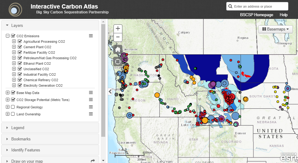
Figure 1: Screenshot from BSCSP Interactive Carbon Atlas.
The second publicly available web-based tool is a rock sample database web application that allows users to see where the sample was acquired, where it currently resides, and allows access to key data. For core samples, users can view photos of the core slabs, see where plugs were taken for analysis, and click on those locations to pull up data tables of test results. BSCSP is in the process of developing a similar application for the Energy Data eXchange (EDX).
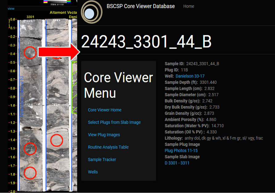
Figure 2: Screenshot from BSCSP Core Viewer
Research vs. Commercial
At future commercial sites, it is unlikely that an operator would be willing to accept the expense and degree of effort associated with the level of characterization and monitoring done for research purposes in the Kevin Dome project. In addition to expense, many of the techniques are not “off the shelf” and are still being developed and optimized for this application. As a consequence of this, there are no established guidelines on how to use the data derived from these techniques for regulatory compliance.
The monitoring and characterization techniques deployed by the Big Sky Carbon Sequestration Partnership (BSCSP) project were used to inform models and advance basic science. Lessons learned from analysis of the data acquired will help pare down all techniques available to a sensible suite of techniques that is cost-effective, but which can still ensure a successful and safe geological storage injection program. Data gathered by the partnerships should be invaluable for helping regulatory agencies make decisions on what will be required to verify storage integrity and assure human and environmental safety in future large-scale commercial projects.
Partners
- Montana State University
- Schlumberger Carbon Services
- Vecta Oil and Gas, Ltd.
- Los Alamos National Laboratory
- Lawrence Berkeley National Laboratory
- Altamont Oil & Gas, Inc.
- Idaho National Laboratory
- Bison Engineering, Inc.
- Lamont-Doherty Earth Observatory of Columbia University
- Barnard College of Columbia University
- Oregon State University
- Washington State University
- GroundMetrics, Inc.
- SWCA Environmental Consultants
- FX Drilling Company, Inc.
- TerraTek