


Carbon Storage Atlas
- Why This Location
- Main Research Q&As Discovered
- Lessons Learned
- Story of Interest
- Links to EDX
- Sites
Site: Reclaimed Marshlands – University of Maryland
Lat/Long
Blackwater National Wildlife Refuge, Maryland
Terrestrial Reclaimed Marshlands: 38.40185, -76.070699
Why this Location?
The location was selected to assess two separate tidal marshland sites to compare results between natural and restored tidal marshes.
Main Research Q&As Discovered
The objective of this study was to demonstrate the terrestrial carbon sink capacity of a restored tidal marsh at the Blackwater National Wildlife Refuge by evaluating the vertical and lateral distribution of carbon in a marsh restored in 2003 (i.e., Wildlife Drive Island) and a natural reference marsh (i.e., Barbados Island). The restored and natural marshes at the Blackwater National Wildlife Refuge stored carbon at an above-average rate versus the national average based solely on surficial accumulation, which was probably an underestimate. At the rate of 3.4 metric ton carbon per hectare per year of surficial carbon storage, the proposed 8,000 hectare restoration would store approximately 27,000 metric ton carbon per hectare per year (or 110,000 metric ton carbon dioxide [CO2] per hectare per year).
Lessons Learned
The use of feldspar markers was not a successful method to establish a reference plane for future sampling. The earth anchor method appeared to be a viable method to perform carbon accounting deeper into the soil profile. Methane emissions were expected to be insignificant because this was a brackish marsh; however, monthly measurements of methane emissions indicated that a significant portion of the carbon storage benefit accounted by the surficial carbon deposits in these marshes was offset through methane emissions. Restoring marshes with higher salinity or other conditions that reduce methane generation would be preferable to improve the net greenhouse gas (GHG) balance
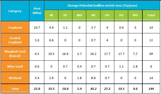
Table 1: Summary of terrestrial storage potential by land type and state as assessed under the MRCSP Phase II project and field validation tests.
Story of Interest
The reclaimed mine lands field testing was conducted at five sites in West Virginia. These sites provided a review of reclaimed mine land practices at several different stages of the reclamation process. This field testing enhanced estimates of the amount of carbon dioxide (CO2) emissions that may be offset through mine land reclamation to grass/legumes in the Midwest Regional Carbon Sequestration Partnership (MRCSP) region.
Links to EDX
Sites
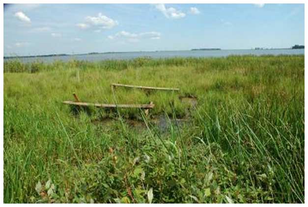
Photograph of tidal marsh.