


Carbon Storage Atlas
- Why This Location
- Main Research Q&As Discovered
- Lessons Learned
- Story of Interest
- Geologic Details
- Links to EDX
- Sites
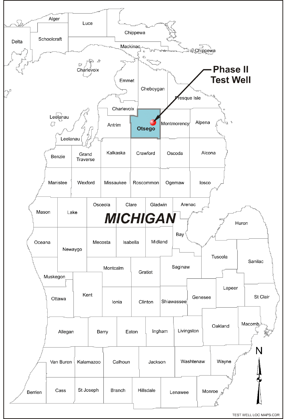
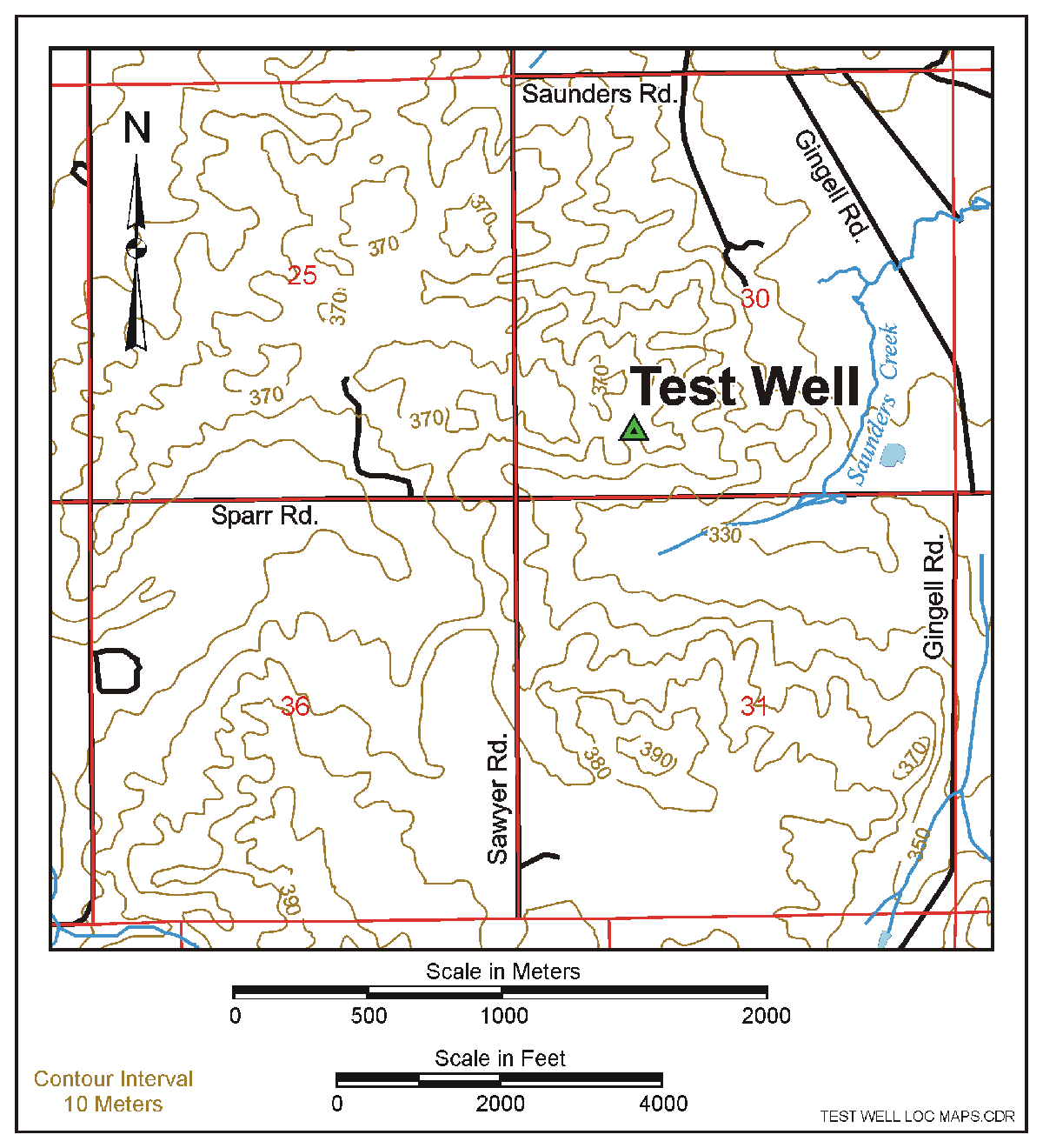
Site: Michigan Basin – Core Energy’s State-Charlton 30/31 Field, Otsego County, Michigan
Lat/Long
State-Charlton 30/31 Field, Otsego County, Michigan
Michigan Basin Otsego County Site: 45.042960, -84.482461
Why this Location?
This location was selected because of its near proximity to an enhanced oil recovery (EOR) field operated by Core Energy, LLC, and a natural gas processing plant that provided carbon dioxide (CO2). The site was also proposed for its prospective geologic storage formations identified during Phase I efforts.
Main Research Q&As Discovered
The main research questions/goals of the field injection test include the identification of deep saline formations suitable for carbon dioxide (CO2) storage, assessing the injectivity and storage capacity of deep saline formations, testing monitoring technologies to monitor CO2 migration and leakage, and conducting local outreach to build a solid foundation of public awareness. The Bass Islands dolomite was identified as the primary injection target as it was made up of approximately 22 meters (~73 feet) of porous dolomite with intervals of anhydrite above and below providing sufficient seals. Based on the success of the initial test for 10,000 metric tons in the Bass Island dolomite, the U.S. Department of Energy (DOE) permitted an expansion to a total of 60,000 metric tons of CO2 at a typical rate of 400 to 600 metric tons per day. The availability of low-cost CO2 also enabled a comprehensive monitoring program, which included wellhead flowmeters, annular pressure monitoring, perfluorocarbon tracer surveys, CO2 surface gas detectors, microseismic sensors, downhole pressure/temperature loggers, crosswell seismic, wireline saturation logging, geochemical analysis of brine samples, formation gas sampling, and cement sampling and evaluation. The suite of monitoring technologies confirmed that the injected CO2 was contained by the confining zone and there was no indication of CO2 migration to the near surface. The outreach effort was ultimately aimed at building a solid foundation of public awareness of this test and for the longer-term implementation of geologic storage in the region. Major outreach tasks included production of informational materials, informal public informational meetings, site tours, and press releases. In general, the project was very well received, due to the prevalence of oil and gas, enhanced oil recovery (EOR) and natural gas processing in the region, and their importance to the local economy.
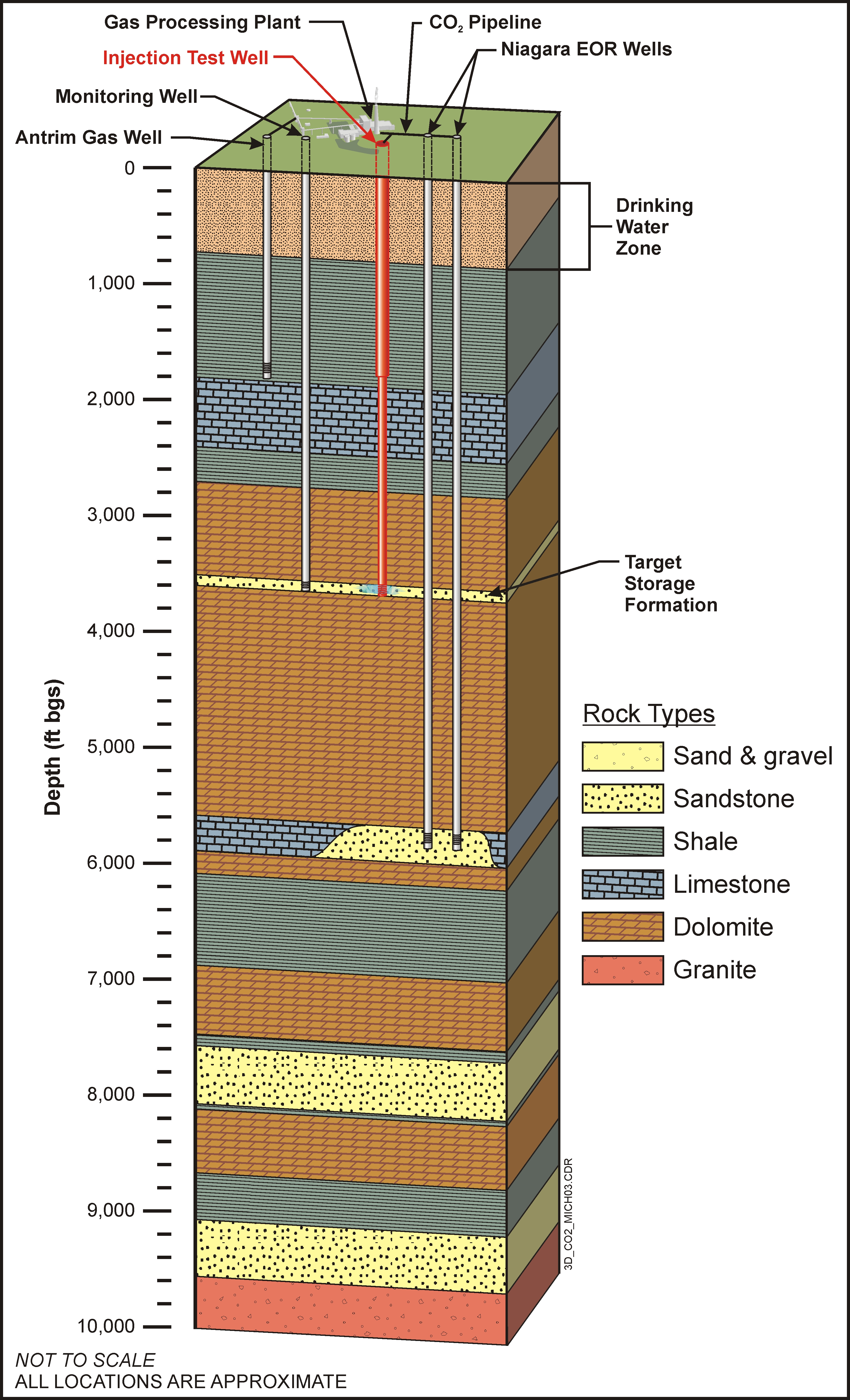
3D schematic of the Michigan field test site showing injection well, monitoring well, and target storage formation.
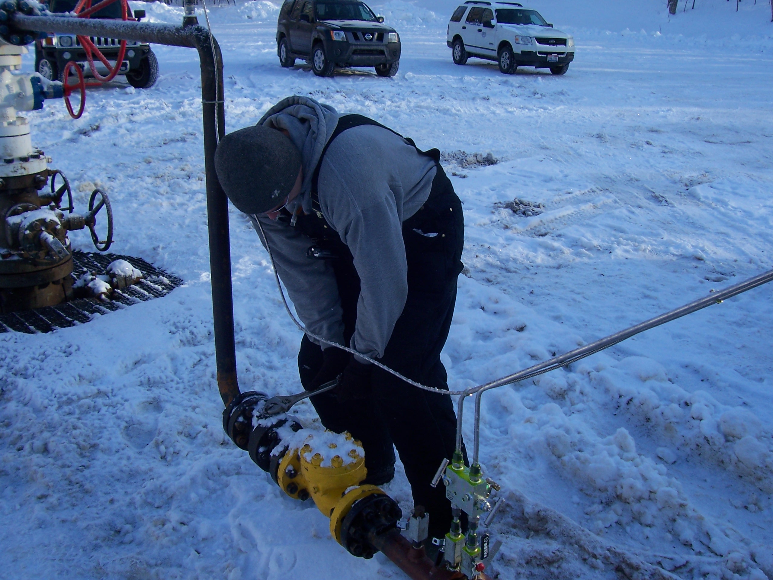
Photograph of field operations at initial injection into the Michigan test well.
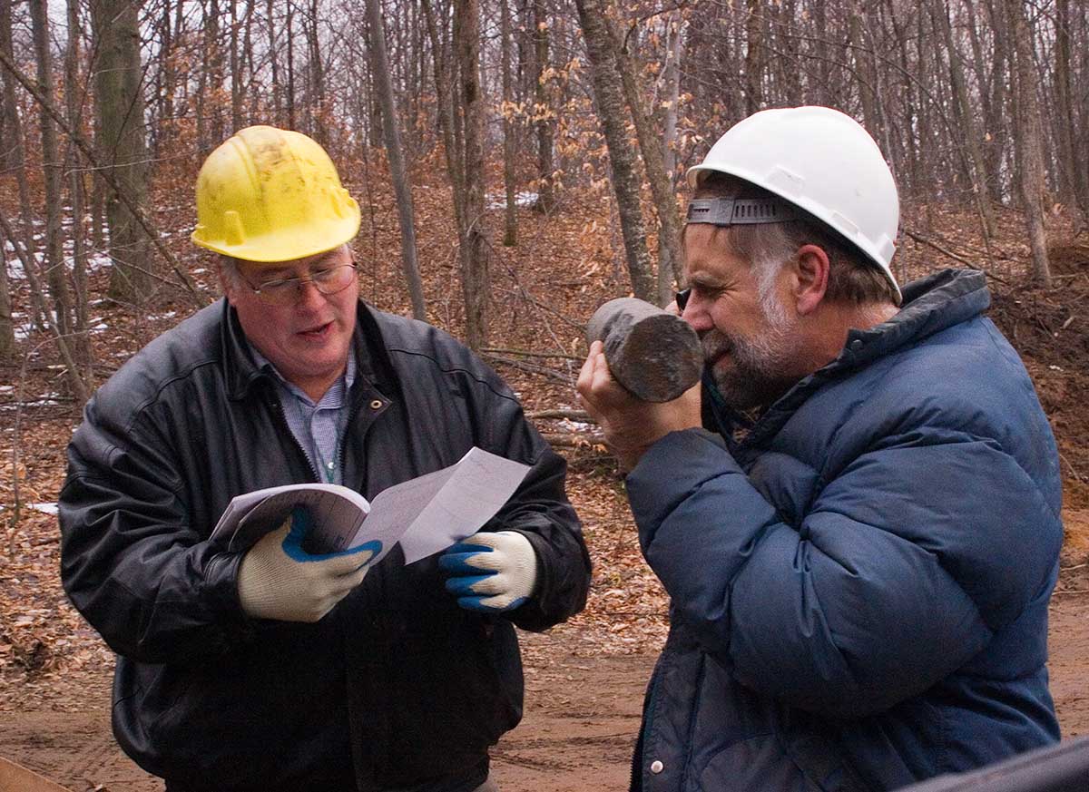
Geology team members Dr. Harrison and Dr. Barnes examining field wireline logs and core collected at the Michigan test well.
Lessons Learned
The collection of new geologic data emphasized the point that geology can change quickly and the importance of having site-specific data for detailed characterization efforts. The short period of injection indicated that the planned injection rates of approximately 600 metric tons per day could be achieved with an acceptable pressure increase. During this short test, it was not possible to determine the maximum injection rate that could be achieved while maintaining safe pressures. The reservoir models evolved significantly in level of detail during the project, from pre-drilling version, to after-drilling, and after-injection versions. Additionally, the monitoring suite was successful at proving containment while detecting vertical migration within the storage reservoir. The effect of short gaps in annual cement was also evaluated. Lastly, entering an area with existing infrastructure for ongoing enhanced oil recovery (EOR) was beneficial to the project.
Story of Interest
The initial geologic assessment was based on available well logs in the area. It suggested that a zone named the Sylvania Sandstone would be the best potential storage zone within the depth range of interest. However, after drilling the test well, the stratigraphy was reevaluated and it was concluded that the Bass Islands dolomite provided the best storage target within the depth range of interest. The Sylvania Sandstone was found to pinch out to the south of the project location. The stratigraphic understanding for this part of the Michigan Basin was altered as a result of new information gained from drilling of the test well.
Geologic Details
The Bass Islands dolomite was the primary injection target with an average porosity of 13% and average permeability of 22 millidarcies (mD). Immediately overlying this was the Bois Blanc formation which was previously poorly understood. The Bois Blanc formation showed characteristics between an injection zone and a caprock with potential for capillary pressure trapping in the cherty sections. It was ultimately included in the injection zone as a secondary target. The overlying Amherstburg and Lucas formations were identified as the primary caprocks with less than 5% porosity and permeability less than detection limits. This careful delineation of injection intervals in permits helped mitigate any regulatory or public perception issues.