


Carbon Storage Atlas
Lat/Long
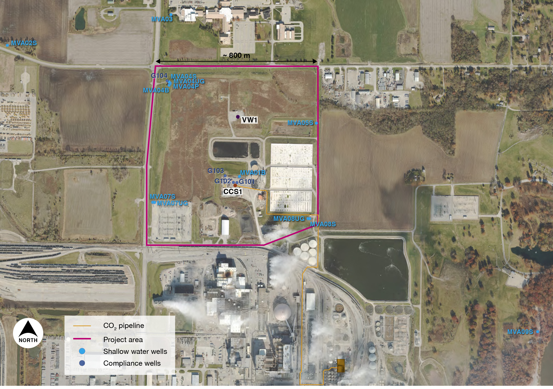
The project site is located on the Archer Daniels Midland (ADM) Company industrial facility and corporate headquarters within the city of Decatur, Illinois – a city with a population of more than 71,000 people (2018). The injection well and verification wells are in a field north of the industrial facilities, and the monitoring, verification, and accounting (MVA) field and study site encompass approximately 0.65 square kilometers (~0.25 square miles). The injection well CCS1 (API 121152341500) coordinates, in the NAD83 datum, are: -88.893410, 39.876963.
Tech Transfer
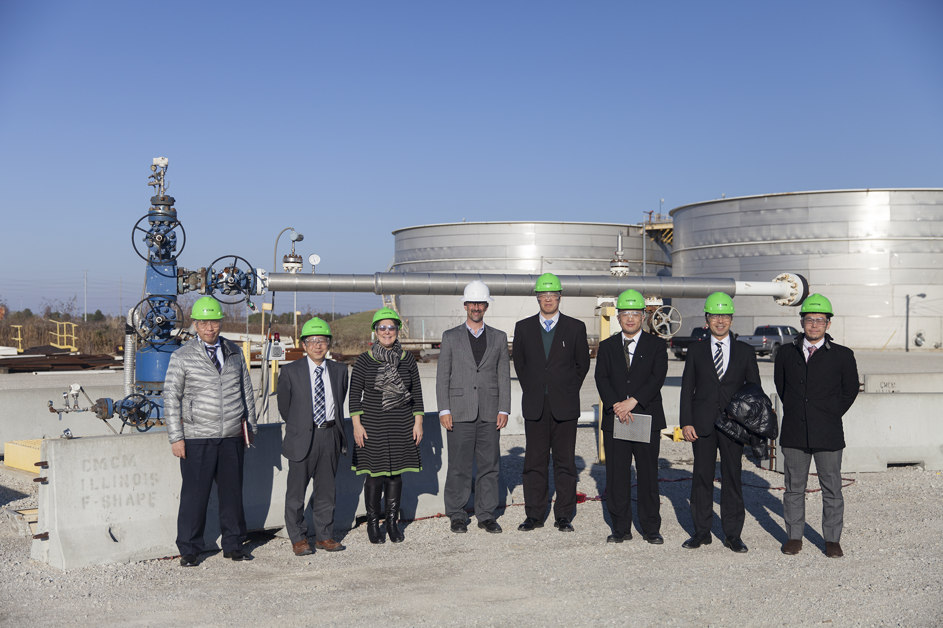
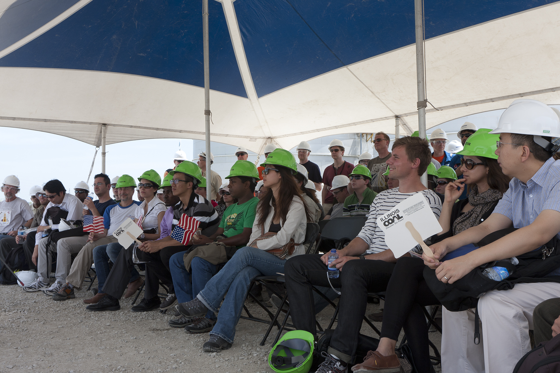
The Midwest Geological Sequestration Consortium (MGSC) has participated in a significant amount of technology transfer and knowledge sharing activities, both at the U.S. and the global level. MGSC has participated in bilateral exchanges between the United States and Norway, the United States and Italy, and the United States and Japan. MGSC has interfaced with international colleagues through a series of International Energy Agency (IEA) Greenhouse Gas R&D Programme (IEAGHG) Greenhouse Gas Control Technologies (GHGT) and other conferences, and hosted more than 2,000 visitors (international and national scientists) at the MGSC site, sharing data and collaborating on projects. In addition, MGSC hosted the IEAGHG Summer School in 2011, which brought in more than 30 students from 29 different countries.
Story of Interest
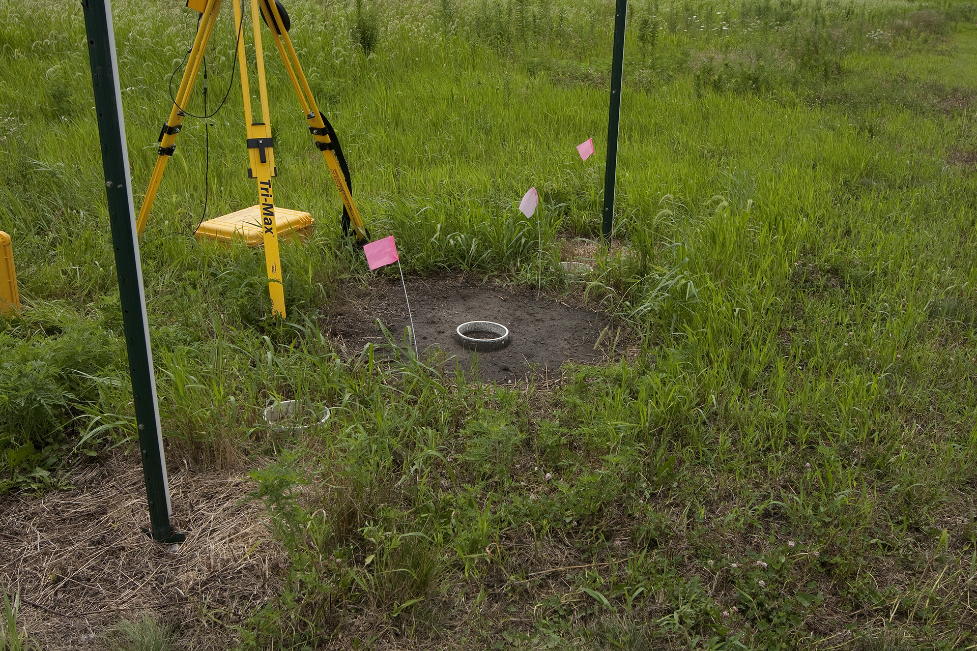
The Illinois Basin – Decatur Project (IBDP) soil carbon dioxide (CO2) flux monitoring program had an extensive network of more than 100 monitoring installations to assess the spatial distribution and temporal variability of soil flux over the duration of the project. An automated CO2 multiplexer was deployed throughout the project phases for data collection at regular, predetermined monitoring intervals in order to assess variability at a fixed location and apply the knowledge gained from that observation to other techniques. However, the multiplexer data collection efforts were frequently interrupted by the activities of the wildlife that moved and lived in the area. Rodents and deer would visit the first deployment location, as well as the secondary deployment location, to chew through the flux accumulation chamber, soil moisture probe, and soil temperature probe wiring, in addition to trampling equipment and infesting the portable power supply. Significant efforts were taken to “armor” the equipment, such as running cabling through steel conduits, setting cages around the accumulation chambers, and sealing access points to the power supplies. Efforts to protect equipment were met with varying degrees of success.
Regional Accomplishments
One focus of the Midwest Geological Sequestration Consortium (MGSC) has been to develop a basin-scale carbon dioxide (CO2) storage model of the Mt. Simon Sandstone to assess potential for future development in order to predict any updip CO2 or brine migration and reservoir pressure increases that could result from commercial-scale, geologic carbon storage within Mt. Simon Sandstone. A basin-scale, multi-phase flow model of the Mt. Simon Sandstone was developed, which covers most of Illinois and Indiana and simulates fluid migration and pressure increases in the Mt. Simon Sandstone, pre-Mt. Simon Sandstone (Argenta), and Eau Claire formations, resulting from commercial-scale geologic carbon storage. The long-term storage of CO2 was simulated, and researchers have linked the basin-scale storage model to an external groundwater flow model to study brine migration and account for groundwater pumping for water supply in northern Illinois and southern Wisconsin. These models allow for better estimates of the storage capacity of the Mt. Simon Sandstone and seal integrity of the Eau Claire formation, integration of future data collection efforts, addressing technical and infrastructure questions (such as optimal well spacing and locations), and designing of monitoring strategies.
The second publicly available web-based tool is a rock sample database web application that allows users to see where the sample was acquired, where it currently resides, and allows access to key data. For core samples, users can view photos of the core slabs, see where plugs were taken for analysis, and click on those locations to pull up data tables of test results. BSCSP is in the process of developing a similar application for the Energy Data eXchange (EDX).
Research vs. Commercial
The primary way in which the Illinois Basin – Decatur Project (IBDP) is different than what would be expected at a commercial site is the size and magnitude of the monitoring, verification, and accounting (MVA) program. The MVA program examined deep, shallow, and near-surface environmental measurements, and the scale of IBDP presented an opportunity to explore emerging technologies and develop methodologies with the long-term potential efficacy for monitoring of commercial carbon capture and storage (CCS) sites.
Many different sampling techniques and methodologies were tested; much greater than what would be required or expected at a commercial site. For example, the soil carbon dioxide (CO2) flux program collected data at more than 100 monitoring ring installations on an approximately weekly basis from June 2009 to June 2015. The soil CO2 flux research monitoring program was initiated in 2009, allowing up to 24 months of pre-injection baseline data acquisition.
The Midwest Geological Sequestration Consortium (MGSC) experience has created a valuable knowledge base that can provide guidance to potential developing commercial sites of proven cost-effective monitoring technologies and methodologies based off vigorous experimental- and research-oriented assessment from IBDP.
Partners
- Montana State University
- Schlumberger Carbon Services
- Vecta Oil and Gas, Ltd.
- Los Alamos National Laboratory
- Lawrence Berkeley National Laboratory
- Altamont Oil & Gas, Inc.
- Idaho National Laboratory
- Bison Engineering, Inc.
- Lamont-Doherty Earth Observatory of Columbia University
- Barnard College of Columbia University
- Oregon State University
- Washington State University
- GroundMetrics, Inc.
- SWCA Environmental Consultants
- FX Drilling Company, Inc.
- TerraTek