Business

Business
This project seeks to improve current methods of time-lapse seismic reflection modeling for carbon dioxide sequestration and miscible CO2 floods in oil and gas reservoirs and to develop new strategies to invert such data to estimate changes in pressure and CO2 saturation over time.
4th Wave Imaging Corp.
Aliso Viejo, CA
Time-lapse seismic monitoring during CO2 injection is still in its infancy. Seismic monitoring requires knowledge of the rock and fluid properties of the oil reservoir to track changes in CO2 saturation and pressure over time. Despite the growing importance of CO2 for EOR projects and geologic storage and sequestration, very little is understood about its physical properties in oil-water/porous rock systems. Further understanding is needed to remotely monitor the injected CO2 and to estimate injected CO2 saturation distributions in subsurface aquifers and reservoirs.
Project Results
This project has resulted in new algorithms to model accurately time-lapse seismic changes during CO2 injection, and to invert these data to estimate changes in reservoir properties, such as pressure and CO2 saturation, that cause the seismic anomalies. Both modeling and inversion algorithms rely on rock physics relations to estimate seismic parameters, such as velocities and densities, as a function of CO2 saturation and pressure.
The major achievements of this project include:
Benefits
Miscible CO2 flooding has become an increasingly important enhanced oil recovery (EOR) technique in the U.S. for recovering residual or bypassed oil. For example, roughly half the CO2 floods in the world are located in the Permian Basin, producing more than 20% of the area's total oil production. A broad application of CO2 EOR methods to thousands of U.S. reservoirs may contribute an additional 43 billion bbl of reserves, which would provide significant revenues to state treasuries, provide thousands of additional domestic jobs, and improve the U.S. trade balance by reducing imports. By developing an accurate approach for tracking CO2 fronts during EOR operations, this project is expected to help improve recovery rates, optimize well patterns, locate bypassed oil, and minimize the cost of injected CO2. Project results also will benefit the public by addressing the potential contribution of CO2 to postulated manmade climate change. By improving current methods for monitoring reservoir leaks and verifying the location and quantity of sequestered CO2, this project will help minimize the impact of CO2 on the environment.
Project Summary
The three major objectives of this DOE/NETL research project are to:
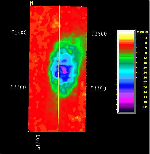
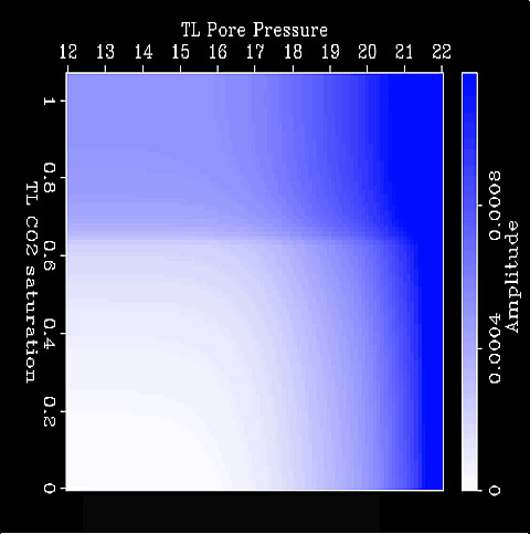
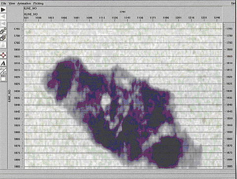
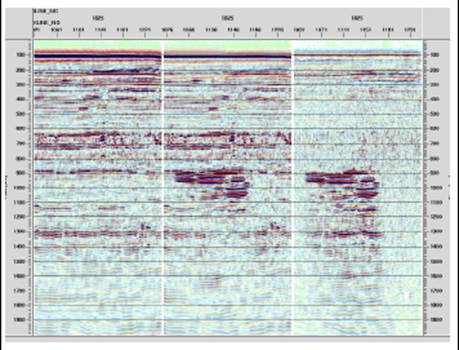
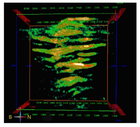
In Phase I of the project, researchers investigated new ways to calculate fluid properties of oil-water CO2 mixtures under varying reservoir conditions using both EOS (equation of state) methods and molecular dynamics modeling. An EOS formulation has been developed that can calculate bulk fluid properties from multiple liquid and gas phases for supercritical CO2 mixtures. In Phase II this EOS has been used to perform 1-D time-lapse seismic modeling to predict changes in seismic data during CO2 injection by calculating how well-log velocities and densities change under varying CO2 saturations and pressures. In addition, progress has been made in building a 3-D seismic modeling tool that can be used to predict time-lapse seismic anomalies in 3-D field data. In Phase III, a method was developed to invert time-lapse seismic anomalies to yield maps of CO2 saturation and pressure changes over time. This method, which was applied successfully to a synthetic dataset, is based on the generation of seismic attribute changes as a function of CO2 saturation and pressure, including changes in both miscible and free CO2 levels. Many of these seismic attributes have been extracted from the Sleipner 3-D time-lapse seismic dataset for use later in the inversion algorithm.
The work has resulted an improved and efficient ability to remotely monitor injected CO2 for safe storage and enhanced hydrocarbon recovery.
(June 2006)
The project is complete. All the tasks of Phase 1, 2, and 3 are completed. The final report is submitted to DOE.
$624,000
$156,000 (20% of total)
NETL-Purna Halder (hurna.halder@netl.doe.gov or 918-699-2083)
4th Wave-Mark Allan Meadows (mark.meadows@4thwaveinmaing.com or 949-916-9787)