Business

Business
The overall goals of this project are to:
Montana Tech/University of Montana, Butte, MT
Ballard Petroleum Holdings, LLC, Billings, MT
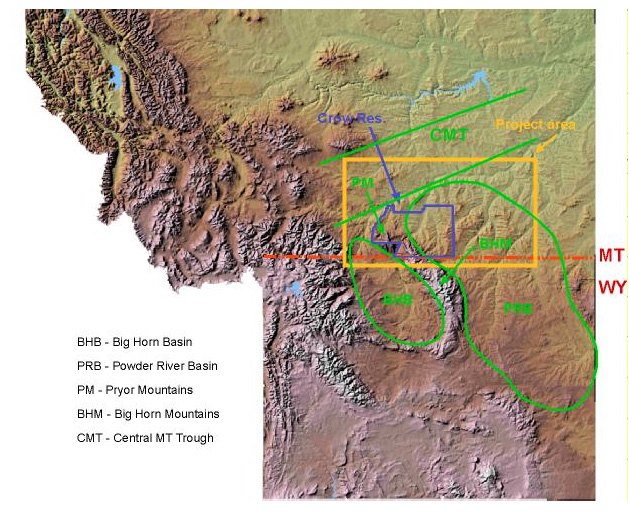
The Permo-Pennsylvanian stratigraphic section in the Big Horn and Powder River Basins is the most prolific oil-producing system in all of the central Rocky Mountain region. Dramatic stratigraphic changes and thinning occur within this section between the Central Montana Trough and the Big Horn and Powder River Basins to the south. The erosional pinch-out of this system has been the focus of petroleum exploration in the past. Recent work in the northern part of the Big Horn Basin shows that petroleum accumulations are in fact controlled by more-complicated stratigraphic changes that occur south of the erosional pinch-out of this stratigraphic interval.
Project Results
Among the project accomplishments:
Benefits
The main goal of the project is to identify a petroleum exploration fairway based on detailed stratigraphic research in the Permo-Pennsylvanian system across south-central Montana, which includes the northern portions of the Big Horn and Powder River Basins. Understanding the potential for finding large volumes of oil updip from known accumulations along regional stratigraphic truncation traps will be of great significance and benefit to the oil and gas exploration industry in the region.
Because the studies target a region centered on the Crow Reservation of Montana, furthering the geologic knowledge in the area could benefit the Crow Tribe as well. Earlier DOE-funded studies led by the same researcher leading this project identified exploration prospects on Crow tribal lands that led to plans for the first exploratory well to be drilled on the reservation in decades (Techlines, June 24, 2005, www.netl.doe.gov).
Project Summary
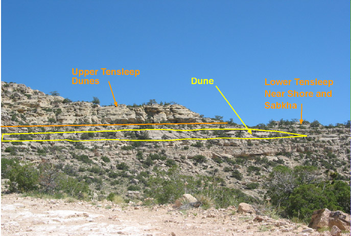
The research will be conducted as outcrop studies, producing oil field studies, and regional subsurface investigations. The main objective of the outcrop studies is to develp a sequence stratigraphic framework for the Permo-Pennsylvanian stratigraphic section and to determine where reservoir facies developed within that framework. In the detailed oil field studies, the producing horizons will be interpreted in terms of the sequence stratigraphic framework from Phase 1. In addition, oil samples will be analyzed to test the hypothesis that the Permo-Pennsylvanian fields across the project area are all parts of one petroleum system. In the regional subsurface phase, the findings from Phases 1 and 2 will be extended across the project region using all available subsurface well data and seismic data to identify an exploration fairway and to develop an exploration model for the Permo-Pennsylvanian petroleum system.
(March 2007)
The project is in its second year, which began October 1, 2005. The project was scheduled to be completed September 30, 2006, but the completion date was extended six months to March 31, 2007. Final report products will be delivered and presented during 2007.
$313,594
$89,925 (22% of total)
NETL - Jim Hemsath (James.Hemsath@netl.doe.gov or 907-452-2672)
Montana Tech - David Lopez (dlopez@mtech.edu or 406-657-2632)