
Business

Business
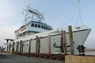
A recent interagency federal research cruise on the University of Delaware’s research vessel Hugh R. Sharp, which sailed along the Mid-Atlantic margin to characterize methane hydrate deposits, yielded 2,000 km of Multi-Channel Seismic (MCS) System data that confirmed previously detected methane hydrates and discovered new deposits. NETL supported the cruise.
A methane hydrate is a cage-like lattice of ice that contains trapped molecules of methane, the chief constituent of natural gas. If a methane hydrate is warmed or depressurized, it reverts to water and natural gas. When brought to the earth's surface, one cubic foot of gas hydrate releases up to 180 cubic feet of natural gas, making it a potentially massive new energy source. Hydrate deposits occur under Arctic permafrost and beneath the ocean floor along continental margins, like the Mid-Atlantic.
This federal research effort to characterize methane hydrate deposits included the U.S. Geological Survey (USGS), the U.S. Department of the Interior’s Bureau of Ocean Energy Management (BOEM), and the U.S. Department of Energy’s (DOE) Office of Fossil Energy (FE). Under an interagency agreement with USGS, DOE, through NETL, is providing more than $1.6 million over four years for continuing methane hydrate research. The funding supported the most recent cruise, known as the Mid-Atlantic Resource Imaging Experiment (MATRIX).
The 2018 MATRIX program is the first airgun program of this size managed wholly by the USGS since 1990s. The streamer deployed for MATRIX was also the longest that the USGS has used on non-specialized vessels since the 1990s.
Researchers acquired six seismic lines running down the continental slope from the shelf-break to waters as deep as about 12,100 feet (3,700 meters) offshore New Jersey, Delaware, Maryland, Virginia, and North Carolina. MATRIX also completed three upper continental slope lines and three deepwater (more than 8,860 feet [2,700 meters] water depth) lines oriented parallel to the coastline in this sector.
The work of the cruise fills a gap in modern seismic data acquisition along the U.S. Atlantic margin and will be used by academic collaborators and other researchers.
“USGS researchers have been involved for decades in investigations that are helping us understand the full extent of the hydrate resource,” Skip Pratt, NETL Project Manager said. “We are pleased that we were able to support a project that is making important advances in understanding gas hydrates. USGS, BOEM, and DOE experts, along with the private sector and academic institutions, are all working together to gain a better understanding of the nature and distribution of marine gas hydrates.”
Contact:

