
Business

Business
Today, the U.S. Department of Energy’s (DOE) Office of Fossil Energy and Carbon Management (FECM) awarded a total of $600,000 to four software developers who won a contest to support FECM’s SMART (Science-informed Machine Learning to Accelerate Real Time Decisions in the Subsurface) Initiative. SMART leverages the expertise of seven national laboratories as well as industry partners, universities, field laboratories and carbon storage regional initiatives to advance the understanding of the subsurface environment through machine learning.
The four winners in Phase 1 of the SMART Visualization Platform Prize Challenge designed prototype platforms and/or mockups that demonstrate a user-friendly visualization platform. The platform concept is intended to transform how scientists, engineers, regulators and the public interact with subsurface data. The winners will develop the prototypes provided by the SMART Initiative technical team.
Each developer will receive a prize of $150,000 for their efforts in Phase 1 and is eligible to move on to Phase 2 to further refine their prototype. During the next 10 months, the four developers will collaborate with FECM’s technical team through online workshops and webinars to develop a SMART Visualization Platform. The winner chosen at the conclusion of Phase 2 will receive the Grand Prize (worth up to $900,000) and may be granted the opportunity to work on future software development projects for the SMART Initiative.
“We are excited to see our Phase 1 winners move forward and advance their projects while working with the SMART technical team,” said National Energy Technology Laboratory’s (NETL) Grant Bromhal, Ph.D., senior fellow, Geological & Environmental Systems. “This challenge will be a first-of-its-kind tool that will use science-based machine learning and data analytics to visualize key subsurface features to quickly and accurately reveal how the subsurface behaves.”
Phase 1 scoring criteria considered each prototype’s innovativeness, functionality, user friendliness and visual appeal, as well as the contestant’s credentials. Phase 1 submissions selected to advance in the competition are:
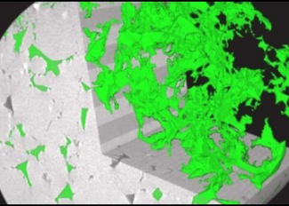
A thorough understanding of the subsurface is necessary to reduce risks and increase the efficiency of geothermal energy technologies, geological carbon storage and other operations.
These visualization tools will allow non-experts and experts alike to interact directly with subsurface data. The goal is to enhance the analysis, interpretation and communication necessary for decision-making in various subsurface applications. The winning tools should help users answer important subsurface questions about reservoir behavior, reservoir composition, injection patterns, uncertainty in measurements and other critical issues.
FECM funds research and development (R&D) projects to reduce the cost of and decarbonize power generation and industrial sources, and to remove CO2 from the atmosphere to further the sustainable use of the nation’s energy resources. To learn more, visit the FECM website, sign up for FECM news announcements, and visit the NETL website.

